Posts

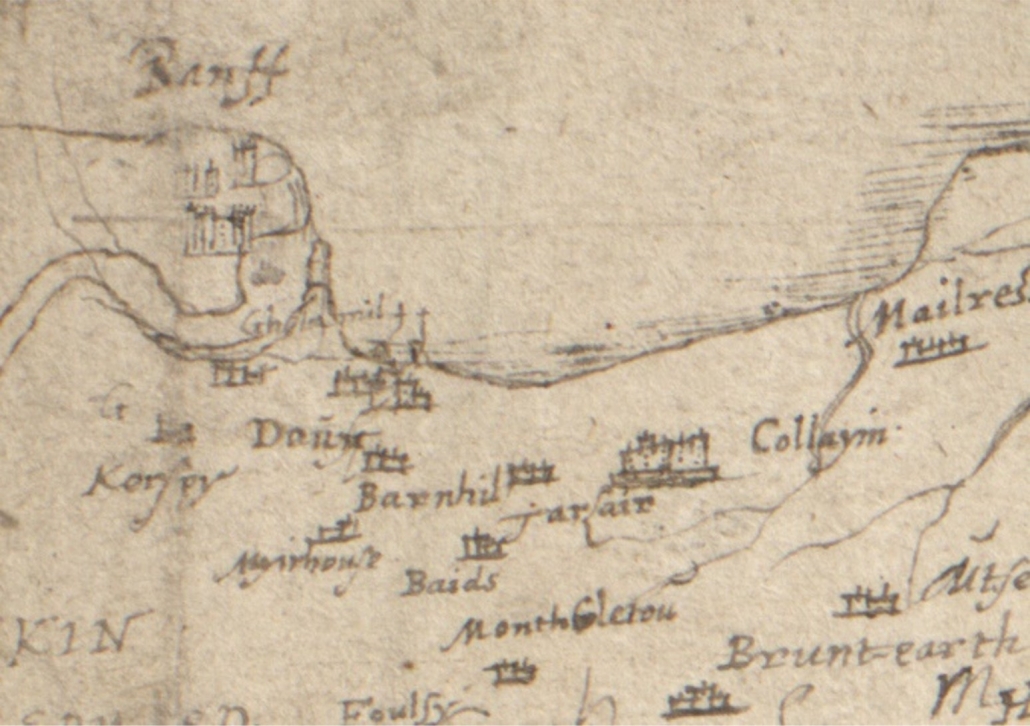
The earliest map that shows any level of detail for Banff or Macduff is dated AD 1600 and names the towns of Banff and Doun, also the settlements of Gellymill, Barnhill and Tarlair. But it also shows the shape of the river mouth, clearly indicating the bar coming from the Doun (Macduff) side.  This expanded estuary covers a much larger area than the river does today, and may well have included not just Greenbanks, but the low lying land where Duff House now stands.

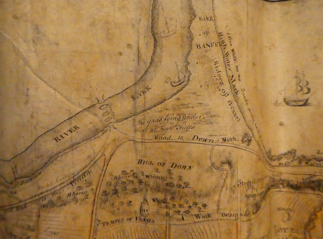
The next image is the first indication of what is a harbour, essentially shared between both Banff and Macduff.  Unfortunately it is a century and a half later before there is another map that gives any detail of the area.  This is the map produced by General Roy in the aftermath of Culloden, to inform the government of potential routes for it’s army around Scotland.  The bar from the Macduff side is clearly still shown, with Greenbanks still submerged.  Duff House is now shown (“Braco’s House”) and the Temple of Venus.

The very detailed map of Macduff in 1763 shows not only the shape of the river, but clearly how the river mouth is used by substantial ships (of their day) as a harbour.  Interestingly this map also shows the piers of the first Banff Bridge, not reportedly completed until 1765.  This map was commissioned as part of the town planning for the new town of Doune – not named as Macduff until 1783.

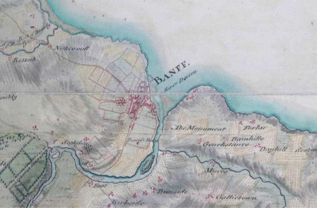
Note: the next available maps are 1772 and 1775.  The former does not show any Banff Bridge, as it had been swept away in 1768. The Taylor & Skinner map of 1775 shows the new Banff Bridge.

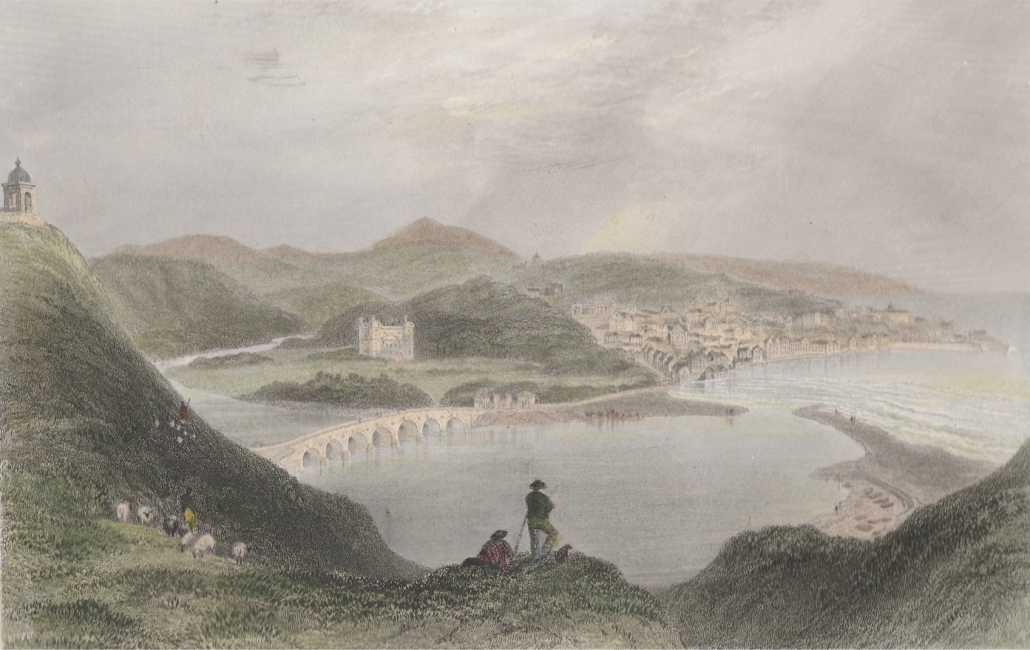
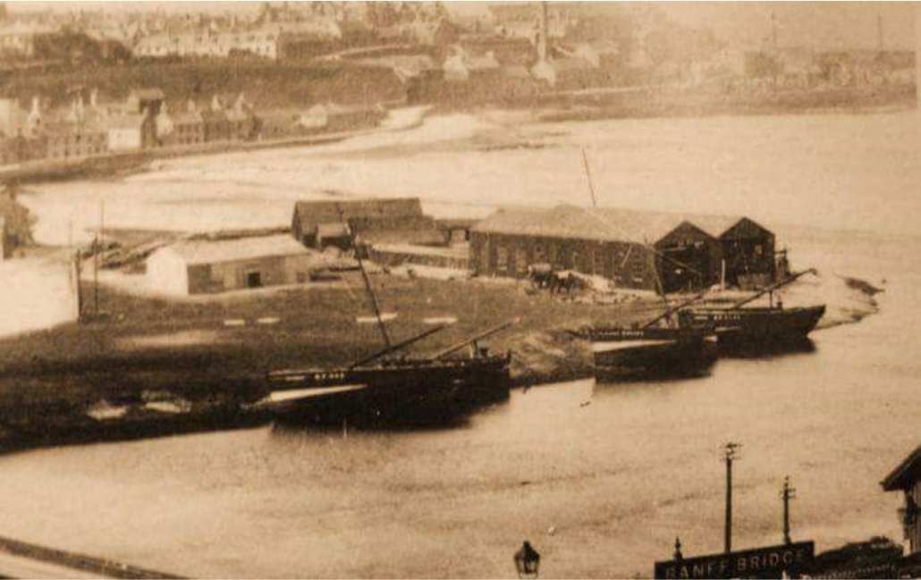
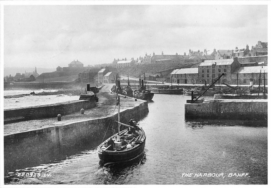
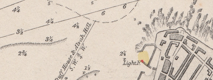
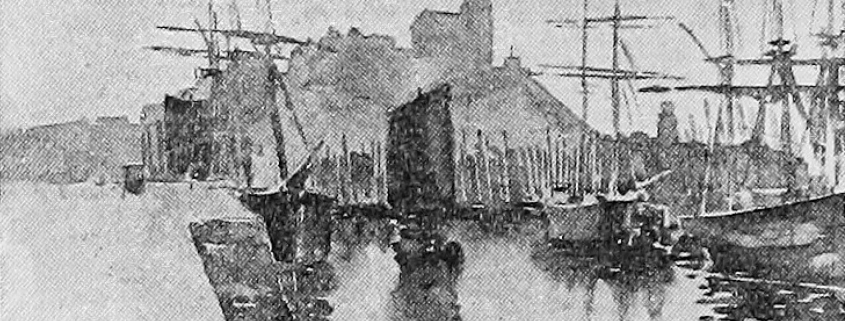
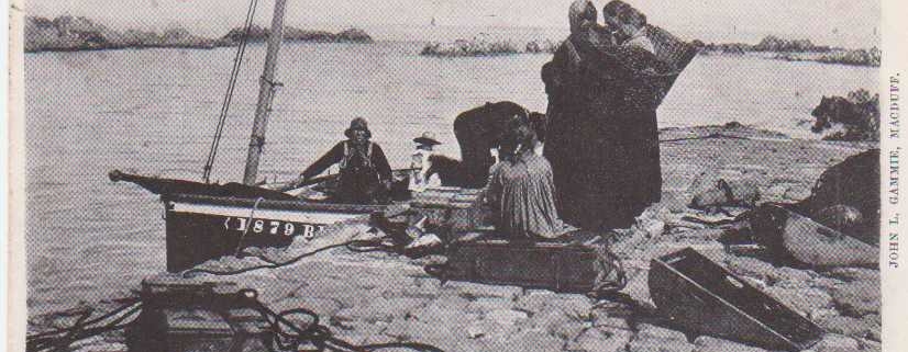
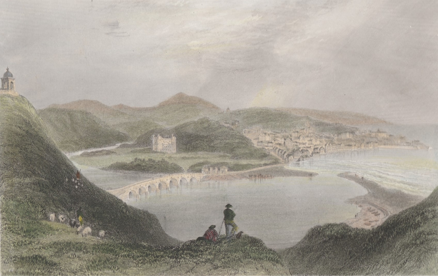
There are also some images which clearly show the estuary, inland of the Bar, being used for shipping.  The colour drawing is 1839.  The black and white photos are late in the 1800’s.  By then there was a shipyard on the Banff side of the river mouth.

1866 Map of Banff Harbour

Walking past the harbour, partially repaired, raised questions about the railway pier and how the harbour had developed. The harbour in Banff is fascinating as for many years it was the home to fishing boats but also ships that sailed the world, bringing in raw materials needed in Banff and the surrounding area and exporting goods from this area.

The earliest mention of a harbour or safe haven is stated by Cramond (The Annals of Banff) to be in 1471, when the “Peel Heife” or Peel Haven, was next to the area used as the site for rebuilding the Kirk of Banff,St Mary’s Kirkyard, and that it had previously been where “boats and small craft were generally moored”.

In the early 1600s, plans were made for a harbour at Guthrie’s Haven and in 1625, James McKen, Fraserburgh, was employed to clear Guthrie’s Haven of rocks. (where the harbour is now) Records were found of people contributing £88 14s. 10d. towards building the harbour in 1626.

By the 1730s the harbour was still not complete and the town was unable to complete the work within a year as funds were low, despite gaining funding from across Scotland by voluntary contributions, so the storms in winter destroyed much of the work undertaken in the previous summer.

A renewed effort brought more contributions from across Britain and Europe e.g. Provost Hamilton in Bordeaux sent strong claret which was “rouped for eight guineas” and an order was issued by the Council for “a man from every family in town to work for a whole day or two tides, for carrying off the chingle thrown in to the harbour of Guthrie”

By 1760 there was “a basin with two piers, in which a ship of a hundred tons can lie with safety”.

By 1770 a new harbour was planned and the foundations were being laid, according to a plan by John Smeaton.

By 1818 further improvements were needed and a plan was drawn up by Mr Thomas Telford. The works were to cost £14,000 and consisted of building new piers. The work was not without problems as a storm in 1828 wrecked part of the partially built pier and the pier then had to be built higher and thicker.

Throughout its existence regular maintenance and improvements have been needed.

From approximately 1859 to 1910 the Banff, Portsoy and Strathisla railway ran right to the harbour but in 1910 the link to the harbour was dismantled. It can be seen on the map of 1866. The National Library of Scotland has several maps of Banff that show how the harbour has changed over time.

The harbour has faced periods of great prosperity and some really difficult periods so hopefully better times will return soon for this wonderful historic harbour.

Portrait of George Robinson

In 1817 George Robinson, the greatest of Banff’s Provosts, after 34 years of running the town’s affairs, presented the Head Court with a statement of what had been achieved in that time. It was an impressive list, and what was more, everything was costed, and the town was still solvent. 

Not everything had been plain sailing. His first move in 1785 had been to arrange for Banff to have its own Customs House, because until then every boat had to send an officer overland to Aberdeen to get the paperwork signed (that meant an overnight stay in those days). This excellent move was thwarted because Banff had two rival earls, each of whom wanted the right to appoint the local exciseman, and we had to wait till these two earls were dead in 1807 to find a compromise, and get our own Customs House. 

Other reforms came more easily. There was a new east quay at the harbour, a grand new parish church, new meal houses in the (Old) Market Place, and a new town house and jail. There were new turnpike roads, and the new entry to the town along Bridge Street. There was a new water supply for Banff. They put a new upper storey on the Academy, doubling its size. After the high tides of 1807, which washed away the shingle bar across the river mouth (it came back) there were new sea defences on Low Shore. Also money was laid out to bribe fishermen with boats and free houses, so that they would settle in Banff, hence the Seatown, as Banff became a fishing port. By matching funding, the Council had got a major public grant to enlarge the harbour further.   

Almost all of this had gone through on the nod. The Deacons of the Incorporated Trades would sometimes look at the accounts, hoping to save public money. Provost Robinson had found himself again and again defending the meagre pay given to the schoolteachers. As he said in his statement, “To that system which prevails in Scotland, and by which even the most indigent may receive the benefit of a classical education, is to be ascribed the pre-eminent success of our countrymen in all parts of the world.” He was right, and he had been a very effective Provost. At the north end of Low Street is the arch built for the entrance to the New Market, with his name on it.

Black and white navigational chart showing Macduff harbour and immediate surroundings

Macduff Harbour has had four Lighthouses, the first installed between 1842 and 1845, and moved three times.

Greyscale drawing of Macduff harbour showing three large sailing cargo vessels, with the church on the hill
Grey scale postcard showing boat alongside Rob Laing's Pier, with various Lyall family members

The present Macduff Harbour has not always been the only harbour. The very first detailed map of Macduff – then called “Down” – is dated 1763, and while it shows the beginnings of the present harbour – it also shows a place called “Laing’s Shore”.